Read the London Underground map like a local — understand zones, line colours, step-free Tube stations and the Elizabeth line before you travel.
How to Read the Tube Map
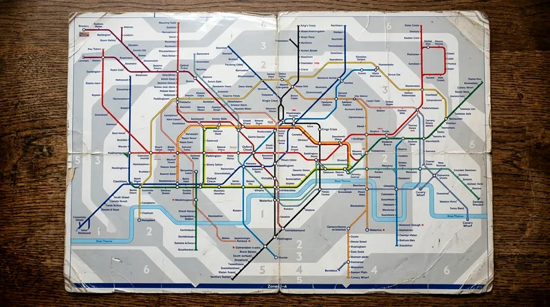
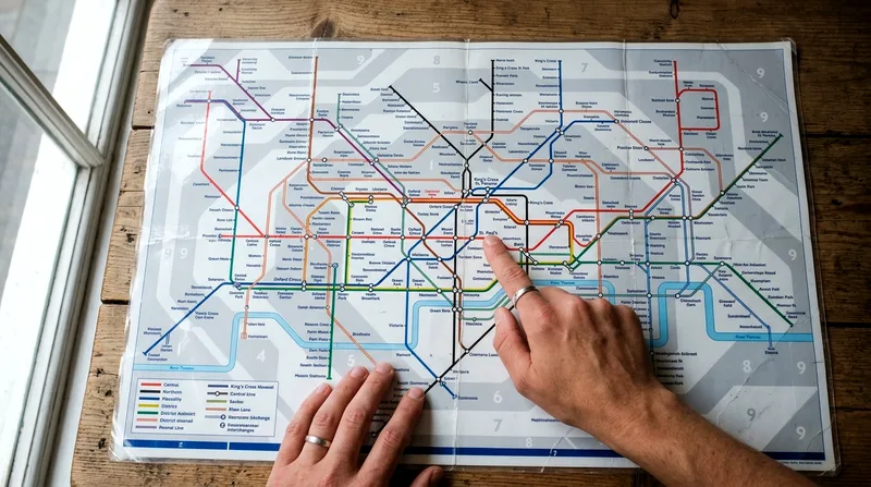
Every London Underground map you'll see — on the TfL website, printed at stations, or in the free app — follows the same design logic first drawn up by Harry Beck in 1931. Lines are shown as straight horizontal, vertical or 45-degree diagonal paths, color-coded by line, with stations marked as ticks and interchanges marked as larger circles or linked rings. That's it. Once you know those three symbols, you can read the whole thing.
The genius of the design is also its biggest trap for visitors: it sacrifices geography for clarity. Bank and Monument stations, for instance, are shown as separate dots but are connected by a walkway and sit only a few hundred metres apart — closer than the map implies. Meanwhile, Covent Garden and Leicester Square look adjacent on the map but are roughly a 10-minute walk apart, and plenty of tourists ride one stop between them when walking would have been faster and cheaper.
I'd recommend downloading the official TfL Tube map PDF or using the TfL Go app before you land, rather than relying on a paper map picked up at the airport, which can be an older print. The app also layers in real-time service updates, which the static map obviously can't show.
Stations, Interchanges and Line Colours
Each of the Tube's lines has a fixed colour that's used consistently across every official map, station signage and train indicator — the Central line is always red, the Piccadilly line always dark blue, the District line always green. Small solid circles along a coloured line represent regular stations where only that line stops. Where two or more lines meet, you'll see a larger open circle, sometimes called an interchange symbol, which means you can change trains there without leaving the ticket barriers. Some interchanges, like King's Cross St Pancras, involve a genuine walk of several minutes between platforms, so don't assume every change is instant.
Why the Map Is Not to Scale
Distances on the Tube map bear almost no relation to real-world distances. Zone 1 stations are stretched out for legibility even though they're often only a few minutes' walk apart, while outer zones are compressed despite covering miles of actual track. This is why Google Maps or a paper A-Z street map is worth cross-checking for short hops in central London — sometimes walking from Oxford Circus to Piccadilly Circus beats queuing for a train that takes one stop plus two sets of escalators.
Tube Lines and Colour Codes
The London Underground network runs on 11 lines, each with a name and colour rather than a number, which trips up visitors used to systems like the Paris Métro's numbered lines or Barcelona's colour-and-number hybrid. The main ones you'll use as a tourist are the Central (red), Piccadilly (dark blue), District (green), Circle (yellow), Jubilee (silver), Bakerloo (brown), Northern (black) and Victoria (light blue) lines, plus the Hammersmith & City (pink), Metropolitan (magenta) and Waterloo & City (turquoise) lines, which see less tourist traffic.
Each line has its own quirks. The District and Circle lines share large stretches of track, so trains can look identical on a platform display until you check the final destination. The Northern line splits into two branches through central London — via Bank or via Charing Cross — which matters if you're heading to London Bridge versus Westminster. None of this is explained well on the physical map itself, which is another reason the TfL Go app's live platform information is worth having alongside the static diagram.
Elizabeth line, Overground and DLR Connections
The Elizabeth line, which opened fully in 2022, appears on the standard Tube map as a thick purple line running roughly east-west through central London, calling at Paddington, Liverpool Street, Tottenham Court Road and Canary Wharf. It isn't technically part of the Underground — it's a separate TfL Rail service with longer, faster trains — but it uses the same Oyster and contactless system and shares stations with Tube lines, so for visitors it functions as one more line to use. It's also the quickest rail link from central London to Heathrow, cutting journey times compared with the Piccadilly line.
The London Overground, shown in orange on the map, and the Docklands Light Railway (DLR), shown in turquoise with a distinct diamond-shaped station symbol, both sit on the same map and accept the same tickets. The DLR is driverless and useful for Greenwich and the O2 Arena; the Overground connects outer neighbourhoods like Shoreditch and Hackney that the deep Tube lines don't reach well.
Zones, Fares and Payment Basics
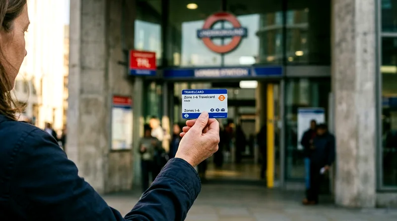
London's transport zones run from Zone 1 (central London, where most major sights sit) out to Zone 9 (covering Stansted Airport territory, though most visitors won't go past Zone 6, which includes Heathrow). Fares depend on how many zones you cross and whether you travel at peak time — generally weekday mornings and early evenings — or off-peak. A single Zone 1-2 journey typically costs a few pounds, with daily price capping meaning you'll never pay more than a set daily maximum no matter how many trips you make, which removes the need to calculate fares trip by trip.
This zonal system differs from Paris, where a single ticket type covers most central journeys regardless of distance, or Dublin's Leap Card system, which is simpler but covers a much smaller network. London's zones reward planning — a hotel in Zone 1 or 2 will usually cost less in daily transport than one in Zone 4, even before you factor in walking time.
Central London's main sights sit almost entirely within Zones 1-2, while airport and outer-borough trips cross into higher zones with different lines.
London Underground map zones and lines compared for visitors
| Zone or Line | Covers | Typical Use | Step-Free Level |
|---|---|---|---|
| Zone 1 | Central London core | Most landmarks, museums, theatres | Mixed, check per station |
| Zone 2 | Inner boroughs | Camden, Greenwich, Shoreditch | Mixed |
| Zones 3-6 | Outer London, Heathrow | Airport transfers, suburbs | Generally better, newer stations |
| Elizabeth line | East-west central spine | Heathrow, Paddington, Canary Wharf | High, mostly step-free |
| DLR | East London, Docklands | Greenwich, O2 Arena, City Airport | High, step-free |
| London Overground | Outer ring, inner suburbs | Hackney, Shoreditch, Clapham | Mixed |
Zone boundaries and step-free status can change as stations are upgraded, so confirm current details on the official TfL map before traveling.
Oyster Card vs Contactless Payment
Most visitors no longer need to buy an Oyster card at all. Tapping a contactless debit or credit card, or a phone/watch with contactless enabled, directly on the yellow readers works on every Tube, bus, Overground, DLR and Elizabeth line service, and it applies the same daily capping as Oyster. The main reason to still get an Oyster card — available as a refundable physical card with a small upfront deposit — is if your bank card charges foreign transaction fees, or if you're traveling as a family and want to load child fares, since under-11s travel free with a paying adult on the Tube but need the right card type to prove it at gates. Avoid buying paper single tickets from machines; they're more expensive than tapping in with contactless for nearly every journey.
Step-Free Tube Stations Explained
Fewer than half of London's Underground stations currently offer step-free access from street to platform — a real limitation compared with newer metro systems in cities like Amsterdam, where accessibility was built in from the start rather than retrofitted into a network dating to 1863. If you're traveling with a wheelchair, a pushchair you don't want to carry up stairs, or heavy luggage, checking accessibility before you travel isn't optional, it's essential.
Reading Accessibility Symbols on the Map
On the official TfL Tube map, a blue wheelchair symbol next to a station name indicates step-free access from street to train, while a different symbol (often shown as the wheelchair icon with an added platform marker) means step-free to the platform only, with a gap or ramp still needed to board. These symbols are small and easy to miss on a printed map, so the TfL Go app's step-free filter, which lets you search routes using only accessible stations, is the more reliable tool for planning on the day.
Planning a Step-Free Journey
Major interchange stations like King's Cross St Pancras, Westminster and Liverpool Street station have step-free access, but some central, heavily touristed stops — including Covent Garden and parts of Camden Town — don't, which surprises a lot of visitors expecting every central station to be modern. The safest approach for senior travelers or anyone with mobility needs is to plan the whole route end to end using TfL's step-free journey planner online before leaving the hotel, rather than assuming accessibility at the destination station matches the one you started at.
Best Lines for London's Main Sights
If you're building a sightseeing plan around the Tube rather than the reverse, a handful of lines do most of the work. The Circle and District lines loop through Zone 1 and cover South Kensington's museums, Westminster and Tower Hill, making them the backbone for a first-timer's itinerary. The Jubilee line is the one to know for Southbank access via Waterloo and for Canary Wharf's modern skyline. Compared with relying on buses — slower but more scenic — the Tube wins for anyone with a tight schedule, though buses are genuinely better for sightseeing along the river on a dry day.
Central London Landmarks by Line
For the British Museum, get off at Russell Square or Tottenham Court Road, both served by the Piccadilly and Central/Northern lines respectively. The Tower of London sits right at Tower Hill on the Circle and District lines. Buckingham Palace is a 10-minute walk from both Green Park (Piccadilly, Victoria, Jubilee) and St James's Park (Circle, District). For the London Eye and Southbank, Waterloo on the Jubilee, Northern and Bakerloo lines is the better bet over Westminster, since crossing the bridge on foot is part of the experience anyway. If you're planning a fuller day-by-day route, our London itinerary guides map these stops out in order.
Airport Connections
Heathrow is reachable directly by both the Piccadilly line (slower, cheaper, part of the standard Tube fare and zone system) and the Elizabeth line (faster, slightly pricier). Stansted Airport isn't on the Tube map at all — it's reached via the separate Stansted Express rail service from Liverpool Street station, which is worth knowing so you don't go looking for an Underground symbol that doesn't exist. Gatwick and Luton also connect via national rail rather than the Tube. If you'd rather not work this out on arrival, pre-booking an airport transfer is a reasonable option, particularly with early flights or heavy luggage.
Frequently asked questions
How do I read the London Underground map?
Treat it as a diagram, not a geographic map. Follow coloured lines between small circles (stations) and larger linked circles (interchanges), and check the zone background shading to understand fare boundaries. Distances on the map don't reflect real walking distances, so cross-check short central London hops with a street map before assuming the Tube is faster.
How many lines does the London Underground have?
There are 11 Underground lines, each identified by name and colour rather than number — Central, Piccadilly, District, Circle, Jubilee, Bakerloo, Northern, Victoria, Hammersmith & City, Metropolitan and Waterloo & City. The Elizabeth line, DLR and London Overground appear on the same map and use the same ticketing but aren't classed as Underground lines.
What are step-free Tube stations?
Step-free stations allow passengers to travel from street level to the train without using stairs or escalators, which matters for wheelchair users, pushchairs and heavy luggage. Fewer than half of Underground stations currently offer full step-free access, so check the wheelchair symbols on the official TfL map or use the step-free journey planner before you travel.
Is the London Tube open 24 hours?
Most lines run roughly 5am to midnight on weekdays, with a Night Tube operating on select lines — historically the Central, Jubilee, Northern, Piccadilly and Victoria lines — on Friday and Saturday nights only. It isn't a full 24-hour system every night, so check current Night Tube coverage on the TfL site if you're planning a late return.
What is the Elizabeth line?
The Elizabeth line is a high-capacity rail line that opened across central London in 2022, running roughly east to west through stations including Paddington, Liverpool Street and Canary Wharf, with a direct branch to Heathrow Airport. It accepts the same Oyster and contactless payments as the Tube and appears on the standard Tube map as a thick purple line, even though it's operated separately from the Underground.